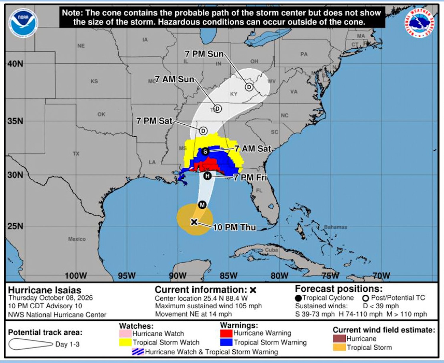
Hurricane Isaias Update (as of Friday, 10/9, 12 pm)HURRICANE ISAIAS HITS SOUTHEAST PEANUT CROP – Hurricane Isaias is now a Category 3 hurricane and will make landfall Friday evening just east of Pensacola in the Western Florida Panhandle. But widespread major impacts will occur across the local area including west and northwest parts of the area from Lake City to Waycross to Blackshear. There will be a localized flood threat since the area is saturated from recent heavy rain, plus there is an isolated tornado threat. Isaias impacts will be significant from Southeast Mississippi to Alabama to the Central and Western Florida Panhandle, including the I-10 corridor, with strong winds, heavy rain and tornadoes well to the east and north of the center. Tallahassee, the Central/Eastern Florida Panhandle and South Georgia should look to be in line for flooding rains and several tornadoes. There are few threats and impacts for Jacksonville, FL Northeast Florida and Southeast Georgia. There will be some peripheral/outer bands moving rather quickly northward, from Isaias, through Saturday that will be capable of very rain, gusty winds and isolated tornadoes.
News Briefs: October 2026Market Watch: October 2026 |